
DJI Mavic 3 Pro and Multispectral Photogrammetry: Georeferenced surveys for kelp, seagrass, estuaries, and other remote coastal ecosystems

Thalassia Environmental has developed survey methods for coastal First Nations, academic labs, and conservation organizations throughout British Columbia. Projects include mapping canopy kelps and seagrass meadows from Vancouver Island to Haida Gwaii, and the North Coast to monitor aerial extent and biomass over decadal timescales. Surveys often include habitats spanning 2–3 kilometres in length in remote and difficult to access locations. Surveys can can be shot in RAW or multispectral formats and can be flown manually or using automated software depending on the complexity of the survey area and research requirements.

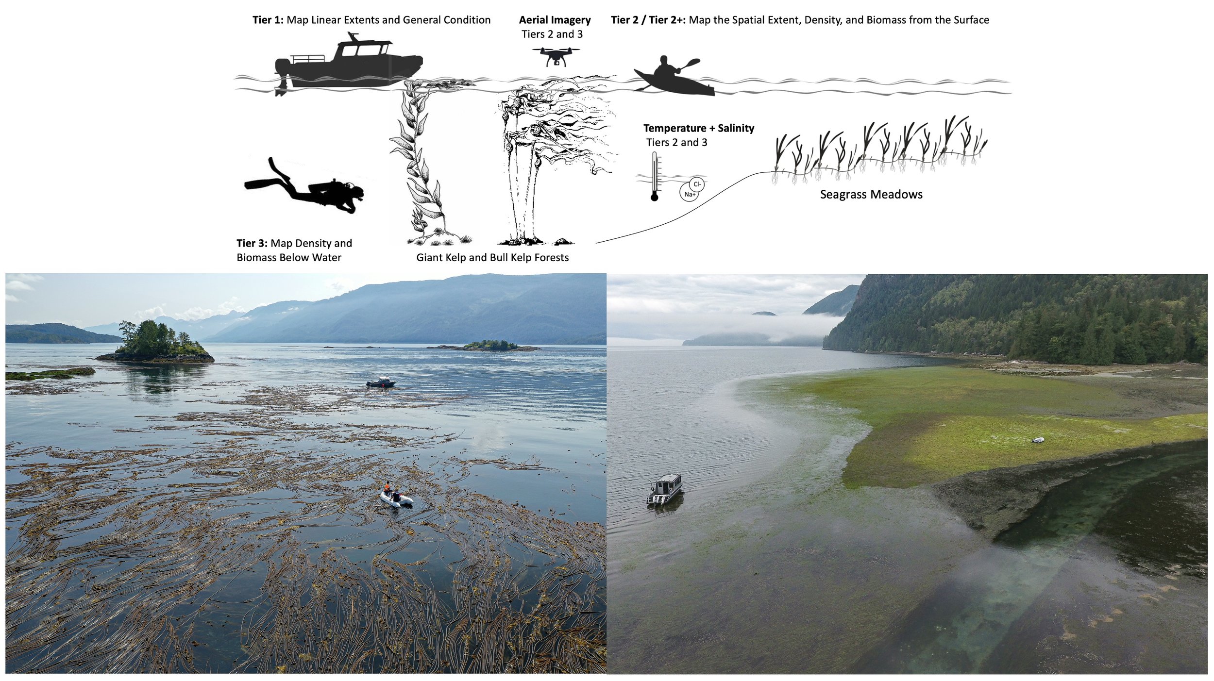
Projects often include dimensions both above and below water. Tier 3 surveys for the Marine Plan Partnership included multispectral photogrammetry drone surveys, kayak transect surveys, and underwater biophysical surveys for bull kelp, giant kelp, and seagrass meadows on North Vancouver Island.